Early spring is making its debut
Published 7:00 am Saturday, February 29, 2020
By Skip Rigney
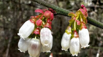
Even if you didn’t have a calendar, early awakening native plants are telling us that we’re in the transition from late winter to early spring. I took a walk in the woods Thursday and saw the telltale red flowers on red maple trees. Closer to ground level were the red flowers of the Florida Anisetree, which, truth be told, is usually more the size of a shrub than a tree.
But, I don’t have to go for a walk in the woods to know that the seasons are changing. I’m reminded every time I get in my pickup truck and look through a windshield covered with yellow pollen from the many water oaks in our neighborhood.
Also, the days are noticeably longer. When we began February, the time from sunrise to sunset was 10 hours and 45 minutes. Today it’s 11 hours and 30 minutes.
Next weekend on Sunday, March 8, we will shift most of that extra daylight to the end of the day when we spring forward into daylight saving time.
Temperatures in Pearl River County during most of February were warmer-than-average, but as the cool spell of the last several days reminded us, it’s still much too early to pack away our sweaters and jackets. Low temperatures on both Thursday and Friday mornings were near or just below freezing throughout the county.
There’s certainly plenty of frigid air still lurking way up north. Low temperatures this week in Fairbanks, Alaska, are forecast to be 20 to 30 below zero, and even the highs aren’t expected to make it above zero.
Depending on whose statistics you use, historically the median date for the last freeze in Picayune is between March 9th and 14th. That means that in 50 percent of years Picayune’s last freeze occurs before that period.
That also means that in the other 50 percent of years, freezes occur after mid-March. Based on past history you have to wait until late March to be 90 percent confident that Picayune has had its last freeze.
For now milder air will be the rule for the weekend and most of the upcoming workweek. Even after the next cool front moves through on Wednesday, forecasters expect highs to be near 70 and morning lows to drop only into the 40s Thursday through next Sunday.
The more significant impact of the next cool front is that it will bring us our best chance of rain for the entire week as it approaches Tuesday night and early Wednesday. There’s even a slight chance that it could touch off some heavy thunderstorms.
The National Weather Service’s Weather Prediction Center expects the main low pressure center along the front to track to our north through Tennessee where heavy rain could make flooding an issue. Fortunately for us, with most of the strong lift to our north, the WPC expects rainfall totals in south Mississippi on Tuesday and Wednesday to be less than one-half inch.
Heavier rainfall totals of one to two inches are expected in central Mississippi in the upper watershed of the Pearl River.
However, in our area the Pearl River is forecast to fall to its lowest levels in nearly a month by the end of the upcoming week according to the National Weather Service in Slidell.