November starts on a dry note
Published 11:58 am Saturday, November 6, 2021
By Skip Rigney
We are in the midst of a typical stretch of dry, autumn weather. It hasn’t rained since the storms of October 27th, making today the 10th consecutive dry day in Pearl River County. No rain is expected until at least Thursday. If that forecast holds true, then we will have gone two weeks without rain.
For the past several days surface high pressure has covered a broad area from New England all the way to south Texas. Indications are that the high pressure system will remain anchored over much the same area through Tuesday.
At higher levels in the atmosphere, several miles above the surface, Mississippi is located this weekend between a ridge of high pressure just to our west and a trough of low pressure moving into the Atlantic off of Georgia and the Carolinas. That will keep winds above us blowing from the north, funneling in additional dry air at those higher altitudes.
All of that adds up to a forecast of mostly clear skies and low humidities for the weekend and the early part of the upcoming work week. The cool air mass that began moving into our area this past Tuesday will continue to cover our region for the next few days.
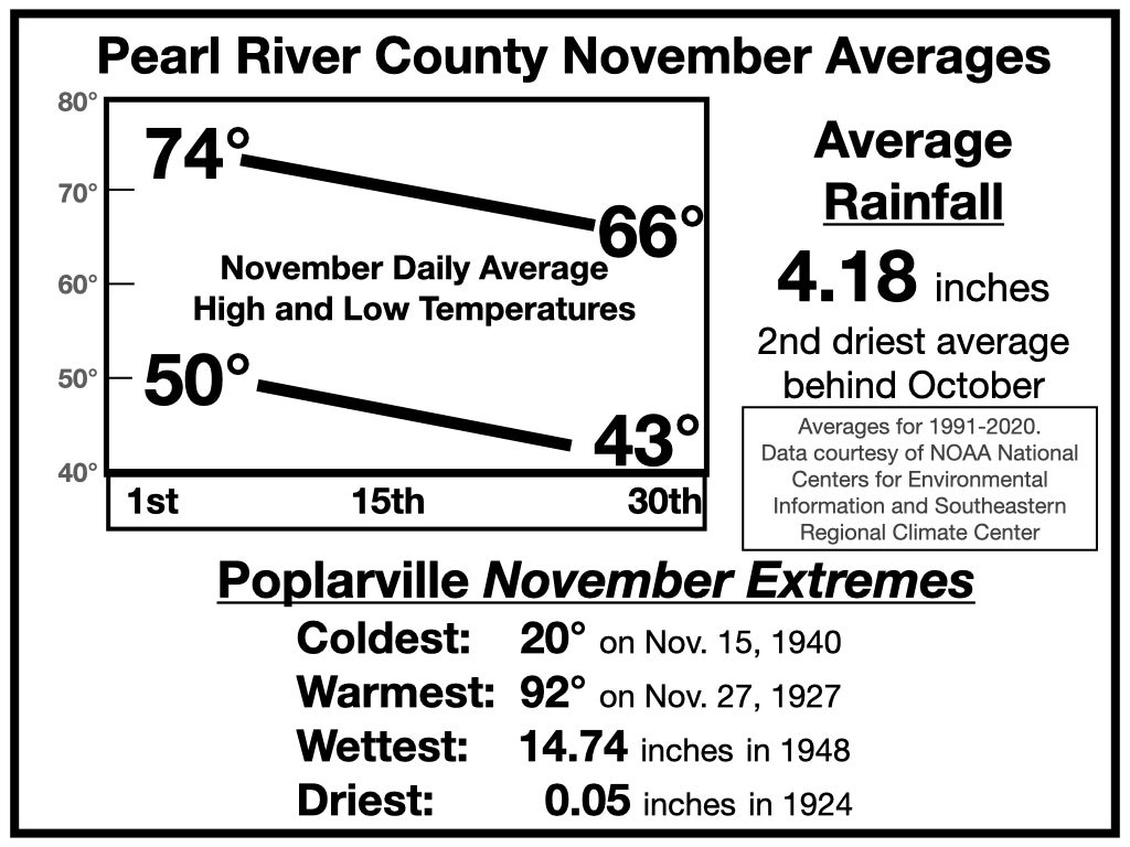
Clear skies will allow for optimal heat loss at night. Early Sunday and Monday mornings will probably be our coolest so far this fall with temperatures near 40 degrees, well below normal.
Bright sunshine will help bring afternoon highs this weekend close to the climate averages for early November, the lower 70s.
As the work week begins, and the center of the high pressure ridge slides further east, winds will veer to the east and south, bringing in a little more warmth and dragging highs into the middle and upper 70s.
The next cool front is predicted to approach sometime between Thursday and Saturday, bringing an end to our dry weather. Behind the front next weekend, temperatures will fall back below the mid-November climate averages.


