NASA chief scientist visits Stennis Center
Published 7:01 am Thursday, February 20, 2014
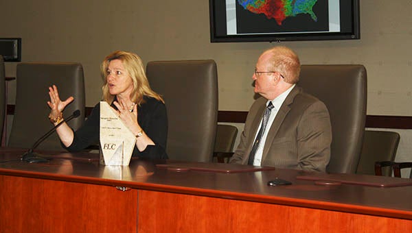
LEARNING TOOLS: Dr. Ellen Stofan, NASA’s chief scientist discusses how NASA’s research affects the general public by helping develop tools that can be used by citizens, other agencies and companies as well as by NASA.
Photo by Will Sullivan
STENNIS SPACE CENTER— Dr. Ellen Stofan, the chief scientist for the National Aeronautics and Space Administration, visited Stennis Space Center on Wednesday to review the research taking place there, including its Life Sciences and Global Information Systems departments’ work.
“I’m incredibly excited to here today … because (Stennis Space Center) does a tremendous amount of research on the Earth. …),” including “climate change and its effects on us … and on the coastline management,” Stofan said.
She said much of the research by NASA and by scientists at Stennis Space Center impacts the decisions companies and people make about their futures.
Stofan came back to NASA from the private sector where she was vice president of Proxemy Research in Laytonsville, MD. While with NASA before leaving for the private sector, she had been a member of several NASA research teams that studied the geology of Venus, Mars, Saturn’s moon Titan and the Earth.
Stofan also had been the senior scientist on several projects at different NASA centers.
Her degrees are from William and Mary College in Virginia and from Brown University in Rhode Island.
Dr. Duane Armstrong, chief of Earth Sciences at Stennis, along with Stofan discussed one of the products that began with NASA research at Stennis in association with the U.S. Forest Service and other agencies.
That product, called ForWarn, was initially unveiled in 2010.
ForWarn uses satellites to keep track of changes in vegetation across the United States to help forest managers know when and where there is danger for wildfire.
Armstrong showed images of how the drought that affected Texas last year appeared so that forest managers knew the extent of it and where wildfire danger was greatest.
He also showed the tracks of the tornadoes that struck Mississippi and Alabama last year and the extent of the drought in California this year where wildfires are already occurring.
Bringing it in closer for local forest managers, he showed where tent caterpillars last year were defoliating trees close to Stennis.
“Taking data and turning it into a product that can be used” is one of the goals of NASA’s scientists, Stofan said following Armstrong’s presentation.
She said users of many of NASA’s products don’t know the science behind them, or even that NASA helped create them, but that they are able to successfully use the products to accomplish a goal is what is important.
“We want everybody to be able to use it (the science),” Armstrong said.