City cautiously begins relaxing
Published 7:00 am Friday, January 31, 2014
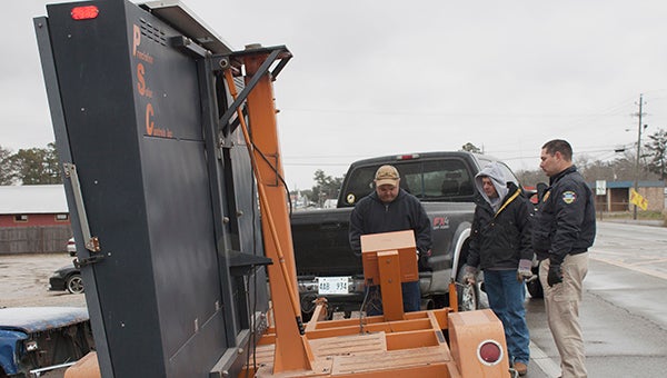
WARNING SIGNS: Upon the closing of U.S. Highway 11 and Boley Bridge on Friday, Huey Stockstill Incorporated’s Randy Burge and Frank Ford assisted Picayune Deputy Chief Chad Dorn by lending the city use of signs warning motorists to slow down due to ice on the road. Photo by Jodi Marze
Picayune city officials cautiously began relaxing Wednesday afternoon as the National Weather Service gave its 2 p.m. briefing on the apparent end of the extreme winter weather that made a rare visit to the Deep South.
The weather service in both the afternoon and morning briefings forecast some slight melting in the ice that had coated bridges and roads, making traveling dangerous from Tuesday through Wednesday. The forecaster said that due to cloud cover, temperatures would rise above freezing for only a couple of hours in part of the region and not at all in other areas, before a hard freeze hit again Wednesday night, with temperatures likely to be even lower than they were Tuesday night, freezing the moisture remaining on the bridges and roads and making them dangerous for travel.
In Picayune, U.S. Highway 11 was reported clear of ice by the time the 2 p.m. briefing began and department heads said they were sending home most workers Wednesday night, but keeping them on call to handle any problems that might arise, especially on area bridges.
City Manager Jim Luke announced Picayune City Hall would be open to public and ready to conduct business at 1 p.m. Thursday, at the same time the county said it would be opening for business as well.
Keith Brown, Picayune fire chief and emergency coordinator, told the group of city officials collected in the conference room at city hall that he didn’t expect to hold any briefing meetings on Thursday.
A question that still is awaiting an answer is whether the Pearl River County and the Deep South will see a repeat of the winter weather the county has experienced this week. Frank Revitte, the weather service’ warning coordinator meteorologist in New Orleans, said at the briefing Wednesday morning there apparently is at least a slight chance late next week, but that the forecasters would only really begin assessing that potential danger after the current emergency is past.
The afternoon forecaster said temperatures Wednesday would drop quickly as the sun set with the dry air that is expected to be in place over the region. Clouds were expected to move out Wednesday night allowing any warmth that collected during the day to escape quickly. He said the area should see freezing temperatures for 12 to 18 hours.
Thursday was forecast to be a generally warmer day and the end of the current round of winter weather griping the area.
The winter weather that began gripping the area on Tuesday followed a short burst of similar weather that hit Friday night when three people were killed and another hospitalized following a three-car accident on the U.S. Hwy. 11 bridge over Hobolochitto Creek. That blast of deadly weather caught forecasters unprepared and the Mississippi Department of Transportation was overwhelmed with calls for assistance, especially south of Hattiesburg where such weather is extremely rare. After the city consulted with MDOT, the city closed the bridge that night and heavily sanded it to provide traction when it was safe to reopen it.
Both MDOT and the city were prepared for the second blast that arrived on Tuesday, though again MDOT was overwhelmed by the extent of the winter weather emergency, and again the city and county stepped in to cover roads and bridges normally under the jurisdiction of MDOT after consulting with that agency.